Ⅰ.Visualizzazione
Il radar di sorveglianza a bassa quota LKST-X115 è utilizzato principalmente per operazioni di sorveglianza a bassa quota e a terra.Dispone di una bassa potenza di radiazione omnidirezionale equivalente fornendo al contempo elevate velocità di ricerca dei datiIl radar incorpora sistemi di soppressione del disordine e di rilevamento di obiettivi densi, raggiungendo tassi di falso allarme estremamente bassi.Può tracciare e stabilire automaticamente la direzione per oltre 300 gruppi target, che fornisce informazioni di posizione di alta precisione.
Ⅱ. I punti salienti
• rilevamento: ≥8 km (quadcopter) / ≥14 km (persona) / ≥15 km (veicolo)
• 300 binari con un raggio ≤ 5 m e una precisione di angolo ≤ 0,4°
• Falso allarme ultra basso in situazioni di grande disordine
• -3° ≈ 60° di altitudine per terreni complessi
• ≤35 kg, ≤330 W per veicoli o bagagli
Ⅲ.Specificità
| Nome del parametro |
Valore del parametro |
| Frequenza di funzionamento |
banda X 9,8 ∼ 10 GHz |
| Copertura dell'altitudine |
- 3° ≈ 60° |
| Copertura azimut |
360° |
| Distanza di rilevamento |
Piccolo quadricottero (RCS 0,01 m2) ≥ 8 km
UAV a ala fissa di piccole dimensioni (RCS 0,1 m2) ≥ 12 km
UAV a ala fissa media (RCS 1 m2) ≥ 15 km
Personale ≥ 14 km• Elicottero/veicolo ≥ 15 km
|
| Altitudine massima di rilevamento |
≥ 2 000 m |
| Zona cieca |
≤ 50 m |
| Precisione di portata |
≤ 5 m (RMS) |
| Accuratezza angolare |
Azimut ≤ 0,4° (RMS) / Elevazione ≤ 0,4° (RMS) |
| velocità di rotazione dell'antenna |
30 giri al minuto (180°/s)
potenziato a 60 rpm (360°/s) |
| Tracce simultanee |
≥ 300 |
| Distanza di velocità di localizzazione |
1 ‰ 150 m/s |
| Rifiuto del disordine |
Immunità al disordine comune |
| Temperatura di funzionamento |
-40 °C a +55 °C |
| Umidità |
≤ 60 % |
| Livello di protezione |
IP65 (unità principale IP67) |
| Peso |
≤ 35 kg |
| Consumo di energia |
≤ 330 W |
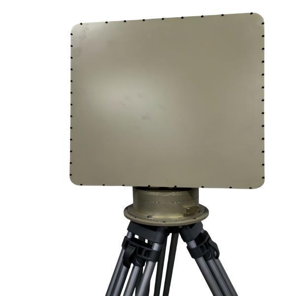
| Dimensioni dell'array |
540 × 675 × 85 mm |
| Risoluzione |
4° (azimut) / 7° (elevazione) |
| Potenza di trasmissione |
≤ 30 W |
Ⅳ.Caratteristiche
1.DBF ad alta velocità di dati per un aggiornamento rapido
2. La soppressione dell'inquinamento adattivo respinge l'inquinamento da pioggia, terra e mare
3. Ampia elevazione per scenari montani e urbani
4Registrazione e riproduzione integrate per analisi post-missione
V. Stile aziendale

Ⅵ.Eventi aziendali

 Il tuo messaggio deve contenere da 20 a 3000 caratteri!